
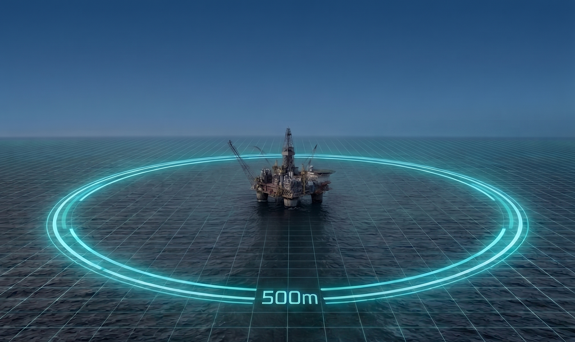
Understanding Offshore Spatial Boundaries
Safety zones protect personnel, offshore structures, and the marine environment from risks including vessel collision, dropped objects, security threats, and damage arising from structural contact or snagged fishing gear. However, managing spatial risks requires recognising that not every offshore boundary carries the same legal weight. Offshore marine operations encounter three distinct types of boundaries:
Statutory Safety Zones: Legally enforceable exclusion zones established under national coastal-state legislation. Entering or remaining in these zones without applicable permission, formal exemption, or other lawful basis may constitute an offence under coastal-state law. These zones can be permanent throughout an asset's operational lifespan or temporary based on project-specific scopes, such as construction, major repairs, or decommissioning campaigns.
Operator Operational Boundaries: Practical clearance limits, safety sectors, and stand-off perimeters defined within an installation's Safety Management System (SMS), field procedures, or vessel charterparty instructions. These serve as internal risk-control measures rather than statutory exclusion perimeters and are communicated through field procedures, vessel instructions, marine co-ordination, and direct communications.
Mooring, Cable, and Subsea Hazard Areas: High-risk areas surrounding assets with extended physical infrastructure. Floating production units (FPSOs) and semi-submersible rigs deploy mooring spreads extending significantly beyond the immediate footprint of the installation. Subsea power, export and inter-array cables, pipelines, and associated infrastructure can also extend well beyond statutory safety zones. Crossing or trawling across these areas introduces significant risks of snagging mooring lines, damaging cables, or interfering with subsea infrastructure, even when a vessel remains entirely outside any statutory safety zone.
Confusing operator-defined clearance limits with statutory perimeters complicates bridge decision-making, operational logs, and formal reporting. Marine crews and field controllers must manage each category according to its proper operational and legal framework for the jurisdiction in which they are operating.
What Does "500m" Mean Across Global Basins?
International maritime law provides the overarching framework for offshore safety zones through the United Nations Convention on the Law of the Sea (UNCLOS). Under Article 60, applied to the continental shelf through Article 80, coastal states may establish safety zones around artificial islands, installations, and structures within their Exclusive Economic Zones (EEZ) and continental shelves. UNCLOS provides that these zones shall not exceed 500 metres from each point of their outer edge, except where authorised by generally accepted international standards.
Two operational realities are critical when applying this framework in practice:
Development Areas versus Statutory Safety Zones: An Offshore Development Area (ODA), wind-farm development area, or petroleum block is not the same thing as a 500-metre safety zone. Project development areas can extend across many square kilometres and define the spatial extent of an authorised or proposed development; they do not, by themselves, create a universal exclusion zone for other vessels. Such areas are often time-constrained and accompanied by stakeholder engagement and navigational communications, including Notices to Mariners and appropriate hydrographic charting information. Where restrictions beyond statutory safety zones are required, they must arise through the applicable domestic consenting, marine planning, navigational, or other formal regulatory frameworks.
Domestic Legislation Governs Scope and Enforcement: UNCLOS provides the international framework, but individual coastal states establish the domestic laws governing how safety zones are created, enforced, and reported. The familiar 500-metre radius is an established benchmark across offshore energy, but it does not automatically apply to every maritime structure worldwide. The legal status of a boundary, the permissions required to enter it, and the consequences of an infringement depend on the applicable national framework.
Operational Risk: The Threat Is Not Limited to Unauthorised Vessels
Maintaining field safety involves managing both third-party traffic and vessels legitimately operating within the field:
Third-Party Traffic and Fishing Interactions: Passing commercial and fishing traffic can create collision, snagging, and infrastructure hazards. Offshore installations routinely assess collision threats and monitor vessel movements using radar, AIS and, where deployed, automated proximity alerts or other detection technologies to identify developing risks early. Fishing activity can also create additional risks around offshore infrastructure. UK HSE has highlighted the risk of fishing vessels trawling close to, but outside, 500-metre safety zones, where gear or vessels may interact with installation mooring systems.
Authorised Attendant Vessels: While third-party shipping requires continuous watch, historical data reveals that a substantial proportion of offshore collision risk originates from authorised traffic. Historical UKCS data illustrates why authorised traffic deserves particular attention: the UK Health and Safety Executive's historical offshore collision database recorded 176 collisions between installations and vessels on the UK Continental Shelf between 1996 and 2015. Of these, 174 approximately 98.6% in that dataset, involved vessels classified as "attendant vessels", typically craft approaching an installation for a legitimate operational reason.
Contributory Factors in Attendant Incidents: More recently, HSE Safety Notice ED01-2025 highlighted a continuing risk of collisions involving attendant vessels across oil, gas, and offshore wind assets. The notice identified recurrent operational factors, including distraction by non-navigational administrative tasks on the bridge, degraded situational awareness, rapidly shifting environmental conditions, and insufficient communication between bridge-team members during live operations.
Offshore Wind Array Complexities: In offshore wind, offshore wind development areas can cover large areas containing multiple contractors, vessel operators, and project stakeholders working simultaneously. Without a common operating picture, responsibility for a vessel's presence or activity can become less clear, making it harder to identify, attribute, and respond to developing risks in a timely manner.
Effective field management is not simply about detecting who enters a safety zone; it is about continuously managing what authorised vessels are doing once they are inside.
Coastal-State Safety Zone & Reporting Directory
When a vessel infringes a safety zone, or when a vessel or offshore installation is involved in an event that meets the applicable statutory reporting threshold, reporting requirements depend on the jurisdiction, installation type, and incident classification. There is no single global reporting mechanism.
The directory below summarises the statutory basis, boundary parameters, and official reporting channels identified across key offshore operating coastal states. Where a dedicated safety-zone infringement mechanism could not be identified in the official sources reviewed, this is stated explicitly rather than inferred from general maritime or petroleum reporting requirements:
United Kingdom Continental Shelf (UKCS)
Statutory Framework & Authority: Primary legislation governing offshore safety zones is established under the Petroleum Act 1987 (oil and gas) and the Energy Act 2004 (offshore renewables). Offshore health and safety is regulated by the Health and Safety Executive (HSE) and environmental oversight by the Offshore Petroleum Regulator for Environment and Decommissioning (OPRED), operating jointly under the Offshore Major Accident Regulator (OMAR) partnership for major offshore hazards, with maritime navigation safety administered by the Maritime and Coastguard Agency (MCA).
Safety Zone Parameters: Under Section 21 of the Petroleum Act 1987, a 500-metre safety zone is established automatically around qualifying installations used for specified petroleum-related activities, subject to statutory exclusions (with moorings disregarded when determining the zone perimeter). Section 22 provides for safety zones to be established by order in specified circumstances. Offshore renewable safety zones operate separately under the Energy Act 2004. Under the associated Energy Act 2004 (Safety Zones) Regulations 2007, standard safety zones are declared up to 500 metres during construction, extension, decommissioning, and major maintenance, and 50 metres during operational phases.
Incident & Infringement Reporting: Infringements of an offshore safety zone should be reported using HSE Form OIR13 in accordance with HSE Operations Notice 11. The guidance sets out the evidence that should be provided and the official submission addresses printed on the form. Under Scots criminal law, establishing an offence requires corroboration; HSE Operations Notice 11 specifies that for infringements occurring in Scottish waters, an OIR13 submission must include at least two witness statements. Where an incident independently meets statutory reporting criteria under offshore health and safety legislation, additional reporting through the HSE ROGI Guidance framework may be required (a safety-zone infringement alone is reported using Form OIR13 rather than ROGI). Navigation safety and charting matters are directed to the MCA Navigation Safety Branch via the MCA Guidance Portal (navigationsafety@mcga.gov.uk).
Norwegian Continental Shelf (NCS)
Statutory Framework & Authority: Offshore petroleum operations are regulated by the Norwegian Ocean Industry Authority (Havtil) under the Norwegian petroleum regulatory framework, with search and rescue operations co-ordinated by the Joint Rescue Coordination Centre (JRCC).
Safety Zone Parameters: The Norwegian framework provides for safety zones around offshore petroleum facilities, normally extending up to 500 metres horizontally from the facility's extreme points under Section 52 of the Framework Regulations. The zone is established when the facility or, for mobile facilities, the anchoring arrangement is deployed. Subsea facilities, pipelines, and cables are treated separately under the regulations.
Incident & Infringement Reporting: Under Section 29 of the Management Regulations, operators must ensure immediate, co-ordinated telephone notification to Havtil for specified serious or acute hazard and accident situations, followed by written confirmation in accordance with Havtil's notification requirements via Havtil Notification & Reporting Guidance. Separately, Section 58 of the Framework Regulations requires operators to report safety-zone violations to the appropriate police authority and Havtil. Where a safety-zone situation can result in a serious safety risk, notification to the relevant JRCC and Havtil is also required.
The Netherlands (Dutch Continental Shelf)
Statutory Framework & Authority: Offshore mining activities are regulated by State Supervision of Mines (Staatstoezicht op de Mijnen – SodM), with marine traffic and surveillance co-ordinated by the Netherlands Coastguard (Kustwacht).
Safety Zone Parameters: Under Article 43 of the Dutch Mining Act (Mijnbouwwet), a safety zone extends 500 metres around a mining installation. Within that zone, entry or presence is prohibited except in specified circumstances or where an exemption applies. Offshore wind arrays operate separately under the Offshore Wind Energy Act (Wet windenergie op zee), with declared safety zones and designated transit corridors established by ministerial decree.
Incident & Infringement Reporting: Serious operational accidents, dangerous occurrences, and structural impacts must be reported to SodM in accordance with statutory reporting regulations via the SodM Incident Desk. Navigational safety issues, vessel traffic hazards, and safety-zone breaches are co-ordinated with the Netherlands Coastguard Operational Centre (Kustwacht Centrum Den Helder). No separate, dedicated national reporting form specifically for safety-zone infringements was identified in the official sources reviewed; reporting follows general mining and maritime notification pathways.
United States Gulf of Mexico (US GoM)
Statutory Framework & Authority: Dual federal oversight by the United States Coast Guard (USCG) for maritime navigation safety and safety-zone enforcement, and the Bureau of Safety and Environmental Enforcement (BSEE) for offshore facility safety and environmental management.
Safety Zone Parameters: Under Title 33 Code of Federal Regulations 33 CFR Part 147, the USCG establishes and enforces safety zones around designated Outer Continental Shelf (OCS) facilities. The dimensions and conditions of individual safety zones are established under the applicable federal regulatory instruments.
Incident & Infringement Reporting: Safety-zone enforcement and marine-casualty reporting operate through separate federal mechanisms. Reportable marine casualties under 46 CFR Part 4 require prompt notice to the USCG and, where applicable, a written report on Form CG-2692 submitted to the appropriate Coast Guard Sector Office or Marine Inspection Office. Offshore operators are separately subject to BSEE safety and environmental management requirements, including incident investigation and corrective action. These requirements should not be treated as a dedicated safety-zone infringement reporting mechanism.
Canada
Statutory Framework & Authority: Administered regionally under the Atlantic Accord Implementation Acts by the Canada-Newfoundland and Labrador Offshore Energy Regulator (C-NLOER) and the Canada-Nova Scotia Offshore Energy Regulator (CNSOER), with navigation safety overseen by Transport Canada and the Canadian Coast Guard.
Safety Zone Parameters: Under Section 71 of the offshore drilling and production regulations (such as the Newfoundland Offshore Petroleum Drilling and Production Regulations, SOR/2009-316 and the federal Canada Oil and Gas Drilling and Production Regulations, SOR/2009-315), the statutory safety zone around an offshore installation consists of the area within a line drawn at a distance of 500 metres from the outer edge of any part of the installation. Support craft may not enter without the consent of the installation manager, and operators must take reasonable measures to warn approaching vessels of boundaries and potential hazards.
Incident & Infringement Reporting: Operators are subject to statutory notification and investigation requirements for reportable incidents and near misses, with requirements depending on the applicable offshore framework and incident classification. Specific notification procedures should be confirmed with the relevant regulator, including C-NLOER for Newfoundland and Labrador and CNSOER for Nova Scotia, using their respective regulatory portals. Marine casualties and vessel navigation hazards are reported through the applicable federal maritime authorities.
Australia
Statutory Framework & Authority: Offshore petroleum and greenhouse gas infrastructure in Commonwealth waters is regulated by the National Offshore Petroleum Safety and Environmental Management Authority (NOPSEMA) under the Offshore Petroleum and Greenhouse Gas Storage Act 2006 (OPGGS Act). Offshore renewable energy infrastructure is governed under the Offshore Electricity Infrastructure Act 2021 (OEI Act). Commercial vessel safety and navigational hazards are overseen by the Australian Maritime Safety Authority (AMSA).
Safety Zone Parameters: Under Section 616 of the OPGGS Act, NOPSEMA may establish petroleum safety zones by Gazette notice in relation to specified wells, structures, or equipment, with the zone extending up to 500 metres. Entry or presence by a vessel in breach of the applicable safety-zone notice constitutes an offence.
Incident & Infringement Reporting: NOPSEMA investigates notifications and reports of potential safety-zone breaches and provides a specific template, "Report of an alleged safety zone infringement", for reporting suspected infringements via the NOPSEMA Safety Zones Guidance. Separately, reportable safety, environmental, and well-integrity incidents are subject to statutory notification requirements, including oral notification as soon as practicable followed by written reporting within the applicable timeframe. Where a safety-zone event also meets the relevant reportable-incident criteria—such as when a breach requires the facility emergency response plan to be implemented—additional dangerous-occurrence reporting requirements apply. Marine casualties and vessel navigation incidents may also fall under separate maritime reporting requirements administered by AMSA under the Navigation Act 2012.
Mexico
Statutory Framework & Authority: Upstream hydrocarbon operations are regulated by the National Agency for Industrial Safety and Environmental Protection of the Hydrocarbons Sector (Agencia de Seguridad, Energía y Ambiente – ASEA) and the Comisión Nacional de Hidrocarburos – CNH. Navigation safety, maritime policing, and port captaincies are administered by the Secretaría de Marina – SEMAR under the Ley de Navegación y Comercio Marítimos.
Safety Zone Parameters: Navigational safety and security perimeters around offshore platforms, wells, and exploration facilities in the Bay of Campeche and Gulf of Mexico are promulgated through SEMAR maritime decrees and hydrographic notices. Official maritime navigation warnings published via SEMAR DIREDIMOAT establish 500-metre security zones around designated hydrocarbon exploration and extraction facilities, restricting unauthorised vessel transit.
Incident & Infringement Reporting: No dedicated national reporting mechanism specifically for offshore safety-zone infringements was identified in the official sources reviewed. Operational emergencies, fires, and dangerous occurrences are reportable to ASEA under applicable sector safety management regulations, while vessel collisions, unauthorised incursions, and navigation hazards fall under the jurisdiction of the competent local Port Captaincy (Capitanía de Puerto) and SEMAR.
Brazil
Statutory Framework & Authority: Upstream activities are regulated by the Agência Nacional do Petróleo, Gás Natural e Biocombustíveis (ANP), with maritime traffic and navigation safety overseen by the Brazilian Navy Directorate of Ports and Coasts (NORMAM).
Safety Zone Parameters: Offshore drilling and production operations are subject to maritime safety and exclusion requirements established under the applicable Brazilian petroleum and maritime regulatory framework. A 500-metre safety perimeter is commonly applied around offshore installations, but the applicable restriction and its legal basis should be confirmed for the specific installation and operating circumstances.
Incident & Infringement Reporting: Exploration and production incident reporting is governed by Resolution ANP No. 882/2022 (which revoked Resolution No. 44/2009). Initial incident communications and investigation reports are submitted through ANP's SISO-Incidentes system via the ANP Portal. Operations must also comply with applicable Brazilian Navy navigation standards and environmental reporting obligations.
Guyana
Statutory Framework & Authority: Offshore petroleum activities are administered under the Petroleum Activities Act 2023 by the Ministry of Natural Resources and the Petroleum Commission, with maritime administration, navigational safety, and vessel traffic governed by the Maritime Administration Department (MARAD) under the Ministry of Public Works.
Safety Zone Parameters: Offshore operational and navigation restrictions are promulgated through Notices to Mariners issued by MARAD, including notices covering FPSO activities, drilling operations, field development, and other offshore work areas. The applicable boundaries and restrictions are activity- and location-specific; no universal statutory 500-metre safety zone applying automatically to all offshore installations was established from the official sources reviewed.
Incident & Infringement Reporting: No dedicated national safety-zone infringement reporting mechanism was identified in the official sources reviewed. Maritime casualties, navigational hazards, and offshore incidents should be assessed against applicable MARAD navigation rules, concession operating agreements, and environmental reporting requirements administered by the Environmental Protection Agency (EPA).
Trinidad and Tobago
Statutory Framework & Authority: Offshore exploration and production operations are regulated by the Ministry of Energy and Energy Industries (MEEI), with maritime safety and vessel administration governed by the Maritime Services Division (MSD) of the Ministry of Works and Transport.
Safety Zone Parameters: Offshore navigation restrictions and operational exclusion areas may be established through applicable maritime notices, petroleum authorisations, and field-specific requirements under the Petroleum Act (Chap. 62:01) and Continental Shelf Act 1969. No universal statutory 500-metre safety zone applicable automatically to all offshore installations was identified in the official sources reviewed.
Incident & Infringement Reporting: No dedicated national safety-zone infringement reporting mechanism was identified in the official sources reviewed. Marine casualties, navigation hazards, and operational accidents fall under general maritime and petroleum reporting administered by the Maritime Services Division and the Ministry of Energy and Energy Industries.
Malaysia
Statutory Framework & Authority: Upstream petroleum activities across Peninsular Malaysia, Sabah, and Sarawak operate under the Continental Shelf Act 1966 (Act 83) and are overseen by Malaysia Petroleum Management (MPM), a division of PETRONAS. Navigation safety and maritime notices are administered by the Marine Department Malaysia (Jabatan Laut Malaysia – JLM).
Safety Zone Parameters: Under Section 6(1)(c) of the Continental Shelf Act 1966, the statutory framework authorises the establishment of safety zones extending to a distance not exceeding 500 metres around offshore installations or devices, with Section 5 applying Malaysian law within that 500-metre perimeter. Standard exclusion perimeters and marine entry restrictions are applied through JLM Notices to Mariners and upstream concession operating standards.
Incident & Infringement Reporting: No dedicated national reporting form specifically for offshore safety-zone infringements was identified in the official sources reviewed. Operational incidents and dangerous occurrences are managed under upstream operating procedures overseen by PETRONAS MPM, while maritime casualties, navigation hazards, and notices fall under JLM.
United Arab Emirates (UAE)
Statutory Framework & Authority: Federal maritime zones are defined under Federal Law No. 19 of 1993, with commercial shipping regulated by the Ministry of Energy and Infrastructure (MOEI). Offshore concession areas and petroleum ports in Abu Dhabi are governed by the ADNOC Petroleum Ports Authority (PPA).
Safety Zone Parameters: Under Article 21 of Federal Law No. 19 of 1993, the statutory framework authorises safety zones around artificial islands, constructions, and installations in the exclusive economic zone and continental shelf, with the statutory rule specifying that the area around them shall not exceed 500 metres measured from each point of their outer edge. This provides statutory authority rather than establishing an automatic blanket zone across all offshore structures. Within ADNOC petroleum port limits, additional port-specific navigation restrictions apply, including requirements concerning vessels approaching installations and craft within port areas. These operational restrictions should not be treated as evidence of a universal 500-metre statutory safety zone applying to all UAE offshore installations.
Incident & Infringement Reporting: No dedicated national statutory safety-zone infringement reporting form was identified in the official sources reviewed. Within ADNOC petroleum port limits, vessels are subject to VTIS and Harbour Master reporting and direction requirements under the applicable PPA Port Regulations, including requirements relating to navigational hazards and maritime incidents.
Qatar
Statutory Framework & Authority: Offshore hydrocarbon operations are governed under state concession agreements administered through QatarEnergy and the Ministry of State for Energy Affairs, with maritime navigation and coastal security overseen by the Ministry of Interior (General Directorate of Coasts and Borders Security) and the Ministry of Transport.
Safety Zone Parameters: Operational safety and exclusion areas around offshore platforms, drilling rigs, and loading facilities are established through applicable maritime notices, charting information, concession requirements, and field-specific operating controls. No single universal statutory 500-metre provision was identified in the general legislation reviewed.
Incident & Infringement Reporting: No dedicated national public reporting mechanism specifically for safety-zone infringements was identified in the official sources reviewed. Operational and industrial incidents are managed under concession Safety Management Systems, while maritime incursions and navigational security events are co-ordinated directly with field marine operations, port authorities, and the General Directorate of Coasts and Borders Security.
Nigeria
Statutory Framework & Authority: Upstream petroleum operations are regulated by the Nigerian Upstream Petroleum Regulatory Commission (NUPRC) under the Petroleum Industry Act 2021 (PIA). Maritime navigation, safety, and vessel administration are governed by the Nigerian Maritime Administration and Safety Agency (NIMASA).
Safety Zone Parameters: The Nigerian upstream regulatory framework establishes extensive offshore safety and operational requirements under NUPRC and the Nigerian Upstream Petroleum Safety Regulations 2024. While safety zones and restricted areas are established around offshore installations through licence conditions and maritime notices, no universal statutory 500-metre safety-zone provision applying automatically to all assets was identified in the primary statutes reviewed; applicable boundaries must be verified for the specific field and installation.
Incident & Infringement Reporting: No dedicated national reporting mechanism specifically for offshore safety-zone infringements was identified in the official sources reviewed. Upstream accidents, fires, and dangerous occurrences are reportable to NUPRC in accordance with upstream safety regulations, while vessel traffic incidents, collisions, and marine casualties fall under NIMASA statutory notification procedures.
Angola
Statutory Framework & Authority: Concession oversight and upstream petroleum safety are regulated by the National Oil, Gas and Biofuels Agency (Agência Nacional de Petróleo, Gás e Biocombustíveis – ANPG), with maritime administration and navigation safety governed by the Agência Marítima Nacional (AMN).
Safety Zone Parameters: Applicable safety-zone and exclusion requirements arise through the petroleum regulatory, concession, and maritime framework, with specific boundaries established through field development approvals, concession requirements, and navigational instruments. No universal statutory 500-metre perimeter applying automatically to all offshore installations was identified in the official sources reviewed.
Incident & Infringement Reporting: No dedicated national safety-zone infringement reporting mechanism was identified in the official sources reviewed. Serious operational emergencies and dangerous occurrences fall under ANPG upstream reporting frameworks, while maritime casualties and navigation hazards are administered through AMN.
Note: Requirements in this directory are jurisdiction-specific. Safety-zone designation, enforcement powers, incident thresholds, and reporting routes are established under the applicable coastal-state framework and may also vary according to installation type, operating phase, and incident classification. Operators should verify current requirements with the relevant regulator and their approved Safety Management System before undertaking operations.
What Evidence Should Be Captured After an Incident?
Effective regulatory enforcement, casualty investigations, and insurance reviews depend on reliable, contemporaneous evidence. While submission formats differ between coastal states, collating a consistent evidence package significantly improves an operator's ability to reconstruct the event and support the factual basis for subsequent filings and investigations:
Core Evidence:
Vessel Identity: Vessel name, IMO number, MMSI, call sign, flag state, and port of registry where available.
Vessel Position and Track: Geographical co-ordinates (preferably referenced to WGS 84), approach trajectory, entry and exit points, Closest Point of Approach (CPA), Time to Closest Point of Approach (TCPA), and speed over ground.
Contemporaneous Timestamps: Synchronised UTC/GMT timestamps applied consistently across screenshots, sensor tracks, radio recordings, and bridge log entries.
Electronic Navigation Logs: Saved ECDIS screenshots, ARPA radar tracking data, and AIS playback showing the target vessel's movements relative to asset boundaries and subsea infrastructure.
Communications Chronology: Time-stamped records of contact attempts on VHF Channel 16 and working frequencies, noting any warnings issued and whether acknowledgments were received.
Operational Authorisations: For attendant vessels, records of active work permits, operational tasking, clearances, and specific hold-point sign-offs.
Witness Statements: Contemporaneous statements from watchkeepers and marine controllers describing visual observations, radar plots, communications, and mitigation actions taken.
Supporting Evidence:
Photographic and Video Context: Where available, high-resolution imagery showing the vessel in the foreground with the offshore installation visible in the background provides valuable context for proximity and scale.
Metocean Records: Contemporary wind speed and direction, wave height, swell, tidal streams, and visibility conditions.
Operational Status: Facility operating mode, active SIMOPS activities, and relevant safety-barrier status during the event.
From Compliance Records to Active Field Management
Managing offshore safety zones is not simply a matter of establishing a boundary and recording an infringement after it occurs. The true operational challenge is maintaining a shared operating picture of vessels, assets, permissions, safety controls, and operational status throughout an activity.
Standard offshore practice relies heavily on pre-entry checks to confirm that equipment, personnel, and operating conditions are verified before a vessel enters the applicable safety or operating zone. These checks remain essential. The limitation is not that checklists are ineffective; it is that they are inherently static, while offshore operations are dynamic. Once a vessel enters the field, weather conditions change, thruster loads fluctuate, and Simultaneous Operations (SIMOPS) introduce shifting hazards.
Digital field management can bridge this gap by connecting vessels, offshore assets, and shoreside teams within a single operational environment:
Safety: Digitally guided workflows and interactive safety gates can ensure that critical pre-entry checks, dynamic-positioning prove-ins, and approach clearances are verified sequentially rather than treated simply as paperwork. This helps identify potential human errors and operational drift before vessels enter close proximity to high-value infrastructure.
Compliance: Live vessel positions, applicable safety-zone geometry, and operational boundaries can be presented within a shared operating picture. Clearances, operational restrictions, and boundary alerts can be monitored in real time, helping prevent unauthorised entry and reducing compliance blind spots.
Workflow: Real-time co-ordination links bridge teams, offshore installation control rooms, and shoreside management, cutting administrative friction on the bridge and creating a structured, time-stamped audit trail of approvals, gate completions, communications, and operational events.
Security and Risk Profiling: The same operational records can also capture events that do not independently trigger a regulatory filing—such as repeated close approaches, warning interactions, unexplained vessel movements, or minor station-keeping deviations. Centralising these operational records makes it easier for operators to identify recurring patterns in collision risk, fishing interactions, vessel behaviour, and other localised threats over time, turning isolated operational events into an accessible risk profile for the asset.
Over time, this creates a more complete operational history of what is happening around an asset, rather than treating each vessel interaction as an isolated event.
The objective is not to replace existing Safety Management Systems, statutory navigation duties, or marine assurance processes. It is to provide a connected operational layer between the vessel, the offshore asset, and shoreside teams—helping operators manage safety, compliance, workflow, and emerging operational risks continuously rather than relying solely on records created before or after an activity.